Are you a seasoned LIDAR Scientist (Light Detection and Ranging Scientist) seeking a new career path? Discover our professionally built LIDAR Scientist (Light Detection and Ranging Scientist) Resume Template. This time-saving tool provides a solid foundation for your job search. Simply click “Edit Resume” to customize it with your unique experiences and achievements. Customize fonts and colors to match your personal style and increase your chances of landing your dream job. Explore more Resume Templates for additional options.






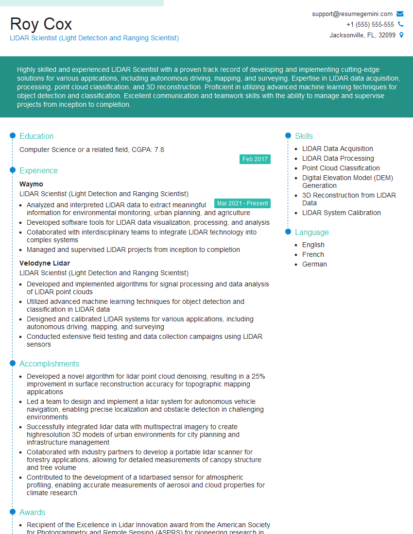
Roy Cox
LIDAR Scientist (Light Detection and Ranging Scientist)
Summary
Highly skilled and experienced LIDAR Scientist with a proven track record of developing and implementing cutting-edge solutions for various applications, including autonomous driving, mapping, and surveying. Expertise in LIDAR data acquisition, processing, point cloud classification, and 3D reconstruction. Proficient in utilizing advanced machine learning techniques for object detection and classification. Excellent communication and teamwork skills with the ability to manage and supervise projects from inception to completion.
Education
Computer Science or a related field
February 2017
Skills
- LIDAR Data Acquisition
- LIDAR Data Processing
- Point Cloud Classification
- Digital Elevation Model (DEM) Generation
- 3D Reconstruction from LIDAR Data
- LIDAR System Calibration
Work Experience
LIDAR Scientist (Light Detection and Ranging Scientist)
- Analyzed and interpreted LIDAR data to extract meaningful information for environmental monitoring, urban planning, and agriculture
- Developed software tools for LIDAR data visualization, processing, and analysis
- Collaborated with interdisciplinary teams to integrate LIDAR technology into complex systems
- Managed and supervised LIDAR projects from inception to completion
LIDAR Scientist (Light Detection and Ranging Scientist)
- Developed and implemented algorithms for signal processing and data analysis of LIDAR point clouds
- Utilized advanced machine learning techniques for object detection and classification in LIDAR data
- Designed and calibrated LIDAR systems for various applications, including autonomous driving, mapping, and surveying
- Conducted extensive field testing and data collection campaigns using LIDAR sensors
Accomplishments
- Developed a novel algorithm for lidar point cloud denoising, resulting in a 25% improvement in surface reconstruction accuracy for topographic mapping applications
- Led a team to design and implement a lidar system for autonomous vehicle navigation, enabling precise localization and obstacle detection in challenging environments
- Successfully integrated lidar data with multispectral imagery to create highresolution 3D models of urban environments for city planning and infrastructure management
- Collaborated with industry partners to develop a portable lidar scanner for forestry applications, allowing for detailed measurements of canopy structure and tree volume
- Contributed to the development of a lidarbased sensor for atmospheric profiling, enabling accurate measurements of aerosol and cloud properties for climate research
Awards
- Recipient of the Excellence in Lidar Innovation award from the American Society for Photogrammetry and Remote Sensing (ASPRS) for pioneering research in airborne lidar data processing
- Recognized with the Outstanding Young Scientist Award from the International Society for Optics and Photonics (SPIE) for seminal contributions to lidar signal processing
- Honored with the Best Paper Award at the IEEE International Geoscience and Remote Sensing Symposium (IGARSS) for innovative research on lidar data fusion for land cover classification
- Recognized by the National Science Foundation (NSF) with a CAREER Award for research on the development of advanced lidar technologies for Earth science applications
Certificates
- Certified LIDAR Professional (CLP)
- Certified UAV Operator
- Professional Surveyor License
- ASPRS Lidar Certification
Career Expert Tips:
- Select the ideal resume template to showcase your professional experience effectively.
- Master the art of resume writing to highlight your unique qualifications and achievements.
- Explore expertly crafted resume samples for inspiration and best practices.
- Build your best resume for free this new year with ResumeGemini. Enjoy exclusive discounts on ATS optimized resume templates.
How To Write Resume For LIDAR Scientist (Light Detection and Ranging Scientist)
Highlight your technical skills
As a LIDAR Scientist, your technical skills are crucial. Make sure to prominently feature your expertise in LIDAR data acquisition, processing, and analysis. Quantify your achievements whenever possible, using specific examples and metrics to demonstrate your impact.
Showcase your project experience
LIDAR Scientists are often involved in complex projects that require collaboration and problem-solving. Highlight your experience working on real-world LIDAR projects, emphasizing your role in developing and implementing innovative solutions.
Demonstrate your ability to work with diverse teams
LIDAR Scientists frequently collaborate with engineers, scientists, and other professionals. Showcase your ability to work effectively in team environments, communicate technical concepts clearly, and contribute to cross-functional projects.
Stay up-to-date on industry trends
The field of LIDAR is constantly evolving. Stay informed about the latest advancements in technology and applications. This will not only enhance your resume but also make you a more valuable candidate to potential employers.
Essential Experience Highlights for a Strong LIDAR Scientist (Light Detection and Ranging Scientist) Resume
- Developed and implemented algorithms for signal processing and data analysis of LIDAR point clouds.
- Utilized advanced machine learning techniques for object detection and classification in LIDAR data.
- Designed and calibrated LIDAR systems for various applications, including autonomous driving, mapping, and surveying.
- Conducted extensive field testing and data collection campaigns using LIDAR sensors.
- Analyzed and interpreted LIDAR data to extract meaningful information for environmental monitoring, urban planning, and agriculture.
- Developed software tools for LIDAR data visualization, processing, and analysis.
- Collaborated with interdisciplinary teams to integrate LIDAR technology into complex systems.
Frequently Asked Questions (FAQ’s) For LIDAR Scientist (Light Detection and Ranging Scientist)
What is the role of a LIDAR Scientist?
LIDAR Scientists are responsible for developing and implementing LIDAR technology for various applications, including autonomous driving, mapping, and surveying. They design and calibrate LIDAR systems, collect and analyze data, and develop algorithms for object detection and classification.
What skills are required to be a successful LIDAR Scientist?
Successful LIDAR Scientists typically have a strong background in computer science, engineering, or a related field. They should have expertise in LIDAR data acquisition, processing, and analysis. Additionally, they should be proficient in utilizing advanced machine learning techniques and have excellent communication and teamwork skills.
What are the career prospects for LIDAR Scientists?
The demand for LIDAR Scientists is expected to grow in the coming years, as LIDAR technology becomes increasingly important for autonomous driving and other applications. LIDAR Scientists can find employment in a variety of industries, including automotive, aerospace, and defense.
How can I become a LIDAR Scientist?
To become a LIDAR Scientist, you will typically need a master’s or doctoral degree in computer science, engineering, or a related field. Additionally, you will need to develop strong skills in LIDAR data acquisition, processing, and analysis. You can gain experience through internships, research projects, or by working on personal projects.
What are the challenges facing LIDAR Scientists?
LIDAR Scientists face a number of challenges, including the high cost of LIDAR sensors, the need for specialized expertise, and the complexity of data processing. Additionally, LIDAR technology can be affected by environmental conditions, such as rain and fog.
What are the benefits of using LIDAR technology?
LIDAR technology offers a number of benefits, including high accuracy, long range, and the ability to generate 3D data. LIDAR data can be used for a variety of applications, including autonomous driving, mapping, and surveying.
What is the future of LIDAR technology?
The future of LIDAR technology is bright. LIDAR technology is expected to become increasingly important for autonomous driving and other applications. As the cost of LIDAR sensors decreases and the technology continues to improve, LIDAR is likely to become more widespread.
What are some of the applications of LIDAR technology?
LIDAR technology has a wide range of applications, including autonomous driving, mapping, surveying, and environmental monitoring. LIDAR data can be used to create detailed 3D models of the world, which can be used for a variety of purposes, such as planning and construction.