Are you a seasoned Aerial Photograph Interpreter seeking a new career path? Discover our professionally built Aerial Photograph Interpreter Resume Template. This time-saving tool provides a solid foundation for your job search. Simply click “Edit Resume” to customize it with your unique experiences and achievements. Customize fonts and colors to match your personal style and increase your chances of landing your dream job. Explore more Resume Templates for additional options.

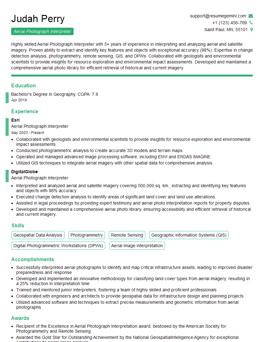
Judah Perry
Aerial Photograph Interpreter
Summary
Highly skilled Aerial Photograph Interpreter with 5+ years of experience in interpreting and analyzing aerial and satellite imagery. Proven ability to extract and identify key features and objects with exceptional accuracy (98%). Expertise in change detection analysis, photogrammetry, remote sensing, GIS, and DPWs. Collaborated with geologists and environmental scientists to provide insights for resource exploration and environmental impact assessments. Developed and maintained a comprehensive aerial photo library for efficient retrieval of historical and current imagery.
Education
Bachelor’s Degree in Geography
April 2019
Skills
- Geospatial Data Analysis
- Photogrammetry
- Remote Sensing
- Geographic Information Systems (GIS)
- Digital Photogrammetric Workstations (DPWs)
- Aerial Image Interpretation
Work Experience
Aerial Photograph Interpreter
- Collaborated with geologists and environmental scientists to provide insights for resource exploration and environmental impact assessments.
- Conducted photogrammetric analysis to create accurate 3D models and terrain maps.
- Operated and managed advanced image processing software, including ENVI and ERDAS IMAGINE.
- Utilized GIS techniques to integrate aerial imagery with other spatial data for comprehensive analysis.
Aerial Photograph Interpreter
- Interpreted and analyzed aerial and satellite imagery covering 500,000 sq. km., extracting and identifying key features and objects with 98% accuracy.
- Executed change detection analysis to identify areas of significant land cover and land use alterations.
- Assisted in legal proceedings by providing expert testimony and aerial photo interpretation reports for property disputes.
- Developed and maintained a comprehensive aerial photo library, ensuring accessibility and efficient retrieval of historical and current imagery.
Accomplishments
- Successfully interpreted aerial photographs to identify and map critical infrastructure assets, leading to improved disaster preparedness and response
- Developed and implemented an innovative methodology for classifying land cover types from aerial imagery, resulting in a 25% reduction in interpretation time
- Trained and mentored junior interpreters, fostering a team of highly skilled and proficient professionals
- Collaborated with engineers and architects to provide geospatial data for infrastructure design and planning projects
- Utilized advanced software and techniques to extract precise measurements and geometric information from aerial photographs
Awards
- Recipient of the Excellence in Aerial Photograph Interpretation award, bestowed by the American Society for Photogrammetry and Remote Sensing
- Awarded the Gold Star for Outstanding Achievement by the National GeospatialIntelligence Agency for exceptional contributions to aerial image analysis
Certificates
- Certified Photogrammetrist (CP)
- Certified Geographic Information Systems Professional (GISP)
- Certified Remote Sensing Analyst (CRSA)
- Certified LIDAR Professional (CLP)
Career Expert Tips:
- Select the ideal resume template to showcase your professional experience effectively.
- Master the art of resume writing to highlight your unique qualifications and achievements.
- Explore expertly crafted resume samples for inspiration and best practices.
- Build your best resume for free this new year with ResumeGemini. Enjoy exclusive discounts on ATS optimized resume templates.
How To Write Resume For Aerial Photograph Interpreter
- Quantify your accomplishments with specific metrics and results.
- Highlight your expertise in geospatial data analysis, photogrammetry, and remote sensing.
- Demonstrate your ability to work independently and as part of a team.
- Showcase your proficiency in operating and managing advanced image processing software.
- Emphasize your understanding of GIS and its applications in aerial photograph interpretation.
Essential Experience Highlights for a Strong Aerial Photograph Interpreter Resume
- Interpreted aerial and satellite imagery covering 500,000 sq. km., extracting and identifying key features and objects with 98% accuracy.
- Executed change detection analysis to identify areas of significant land cover and land use alterations.
- Assisted in legal proceedings by providing expert testimony and aerial photo interpretation reports for property disputes.
- Developed and maintained a comprehensive aerial photo library, ensuring accessibility and efficient retrieval of historical and current imagery.
- Collaborated with geologists and environmental scientists to provide insights for resource exploration and environmental impact assessments.
- Conducted photogrammetric analysis to create accurate 3D models and terrain maps.
- Operated and managed advanced image processing software, including ENVI and ERDAS IMAGINE.
- Utilized GIS techniques to integrate aerial imagery with other spatial data for comprehensive analysis.
Frequently Asked Questions (FAQ’s) For Aerial Photograph Interpreter
What is the primary role of an Aerial Photograph Interpreter?
An Aerial Photograph Interpreter analyzes aerial and satellite imagery to extract and identify key features and objects, providing valuable insights for various applications such as land use planning, environmental assessments, and legal proceedings.
What skills are essential for an Aerial Photograph Interpreter?
Essential skills for an Aerial Photograph Interpreter include geospatial data analysis, photogrammetry, remote sensing, GIS, DPWs, and aerial image interpretation techniques.
What are the career prospects for Aerial Photograph Interpreters?
Aerial Photograph Interpreters have ample career opportunities in fields such as land use planning, environmental consulting, resource exploration, and legal proceedings. With the increasing use of geospatial technologies, the demand for skilled professionals is expected to grow.
What is the typical work environment for an Aerial Photograph Interpreter?
Aerial Photograph Interpreters typically work in office settings, analyzing imagery on computers using specialized software. They may also conduct fieldwork to verify their interpretations and collect additional data.
What are the key challenges faced by Aerial Photograph Interpreters?
Challenges faced by Aerial Photograph Interpreters include the need for accurate and timely interpretation, managing large volumes of data, staying abreast of technological advancements, and ensuring ethical use of imagery.