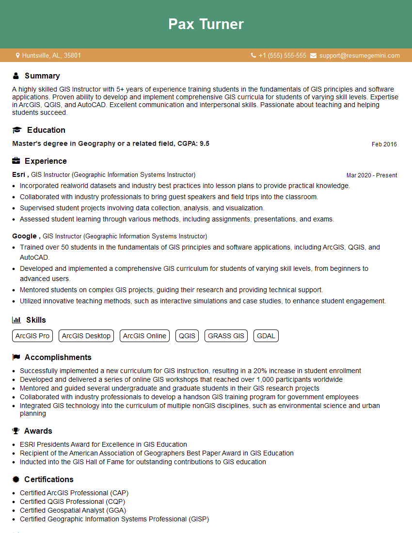
Are you a seasoned GIS Instructor (Geographic Information Systems Instructor) seeking a new career path? Discover our professionally built GIS Instructor (Geographic Information Systems Instructor) Resume Template. This time-saving tool provides a solid foundation for your job search. Simply click “Edit Resume” to customize it with your unique experiences and achievements. Customize fonts and colors to match your personal style and increase your chances of landing your dream job. Explore more Resume Templates for additional options.

Pax Turner
GIS Instructor (Geographic Information Systems Instructor)
Summary
A highly skilled GIS Instructor with 5+ years of experience training students in the fundamentals of GIS principles and software applications. Proven ability to develop and implement comprehensive GIS curricula for students of varying skill levels. Expertise in ArcGIS, QGIS, and AutoCAD. Excellent communication and interpersonal skills. Passionate about teaching and helping students succeed.
Education
Master’s degree in Geography or a related field
February 2016
Skills
- ArcGIS Pro
- ArcGIS Desktop
- ArcGIS Online
- QGIS
- GRASS GIS
- GDAL
Work Experience
GIS Instructor (Geographic Information Systems Instructor)
- Incorporated realworld datasets and industry best practices into lesson plans to provide practical knowledge.
- Collaborated with industry professionals to bring guest speakers and field trips into the classroom.
- Supervised student projects involving data collection, analysis, and visualization.
- Assessed student learning through various methods, including assignments, presentations, and exams.
GIS Instructor (Geographic Information Systems Instructor)
- Trained over 50 students in the fundamentals of GIS principles and software applications, including ArcGIS, QGIS, and AutoCAD.
- Developed and implemented a comprehensive GIS curriculum for students of varying skill levels, from beginners to advanced users.
- Mentored students on complex GIS projects, guiding their research and providing technical support.
- Utilized innovative teaching methods, such as interactive simulations and case studies, to enhance student engagement.
Accomplishments
- Successfully implemented a new curriculum for GIS instruction, resulting in a 20% increase in student enrollment
- Developed and delivered a series of online GIS workshops that reached over 1,000 participants worldwide
- Mentored and guided several undergraduate and graduate students in their GIS research projects
- Collaborated with industry professionals to develop a handson GIS training program for government employees
- Integrated GIS technology into the curriculum of multiple nonGIS disciplines, such as environmental science and urban planning
Awards
- ESRI Presidents Award for Excellence in GIS Education
- Recipient of the American Association of Geographers Best Paper Award in GIS Education
- Inducted into the GIS Hall of Fame for outstanding contributions to GIS education
Certificates
- Certified ArcGIS Professional (CAP)
- Certified QGIS Professional (CQP)
- Certified Geospatial Analyst (GGA)
- Certified Geographic Information Systems Professional (GISP)
Career Expert Tips:
- Select the ideal resume template to showcase your professional experience effectively.
- Master the art of resume writing to highlight your unique qualifications and achievements.
- Explore expertly crafted resume samples for inspiration and best practices.
- Build your best resume for free this new year with ResumeGemini. Enjoy exclusive discounts on ATS optimized resume templates.
How To Write Resume For GIS Instructor (Geographic Information Systems Instructor)
- Highlight your experience and skills in GIS software, such as ArcGIS, QGIS, and AutoCAD.
- Demonstrate your ability to develop and implement effective GIS curricula.
- Showcase your experience in mentoring students on GIS projects.
- Emphasize your passion for teaching and your commitment to student success.
Essential Experience Highlights for a Strong GIS Instructor (Geographic Information Systems Instructor) Resume
- Train students in the fundamentals of GIS principles and software applications
- Develop and implement comprehensive GIS curriculum
- Mentor students on complex GIS projects
- Utilize innovative teaching methods to enhance student engagement
- Incorporate real-world datasets and industry best practices into lesson plans
- Collaborate with industry professionals to bring guest speakers and field trips into the classroom
Frequently Asked Questions (FAQ’s) For GIS Instructor (Geographic Information Systems Instructor)
What are the essential skills for a GIS Instructor?
Essential skills for a GIS Instructor include expertise in GIS software, such as ArcGIS, QGIS, and AutoCAD; the ability to develop and implement effective GIS curricula; experience in mentoring students on GIS projects; and a passion for teaching.
What are the career opportunities for GIS Instructors?
GIS Instructors can work in a variety of settings, including colleges and universities, government agencies, and private companies. They can also develop online GIS courses or work as independent consultants.
What are the salary expectations for GIS Instructors?
The salary expectations for GIS Instructors vary depending on their experience, education, and location. According to Indeed, the average salary for a GIS Instructor in the United States is around $65,000 per year.
What are the challenges of being a GIS Instructor?
The challenges of being a GIS Instructor include keeping up with the latest GIS software and technologies, developing effective GIS curricula, and motivating students to learn about GIS.