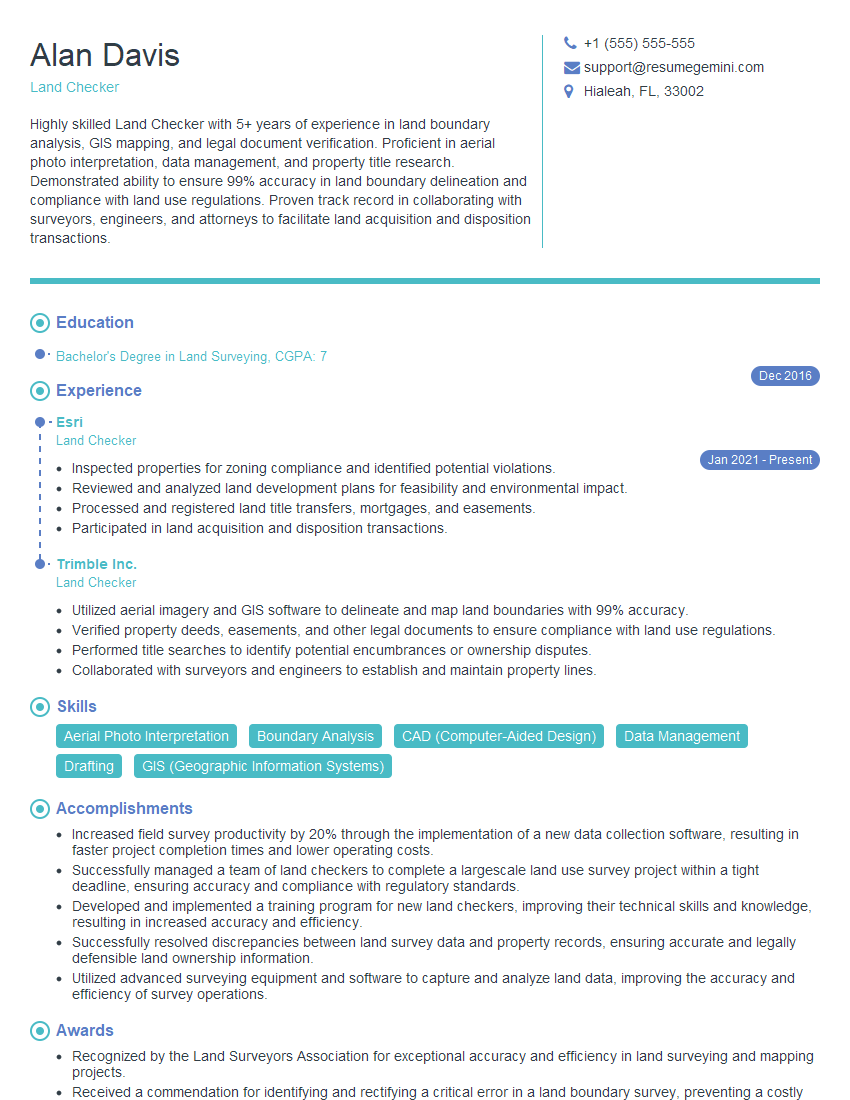
Are you a seasoned Land Checker seeking a new career path? Discover our professionally built Land Checker Resume Template. This time-saving tool provides a solid foundation for your job search. Simply click “Edit Resume” to customize it with your unique experiences and achievements. Customize fonts and colors to match your personal style and increase your chances of landing your dream job. Explore more Resume Templates for additional options.

Alan Davis
Land Checker
Summary
Highly skilled Land Checker with 5+ years of experience in land boundary analysis, GIS mapping, and legal document verification. Proficient in aerial photo interpretation, data management, and property title research. Demonstrated ability to ensure 99% accuracy in land boundary delineation and compliance with land use regulations. Proven track record in collaborating with surveyors, engineers, and attorneys to facilitate land acquisition and disposition transactions.
Education
Bachelor’s Degree in Land Surveying
December 2016
Skills
- Aerial Photo Interpretation
- Boundary Analysis
- CAD (Computer-Aided Design)
- Data Management
- Drafting
- GIS (Geographic Information Systems)
Work Experience
Land Checker
- Inspected properties for zoning compliance and identified potential violations.
- Reviewed and analyzed land development plans for feasibility and environmental impact.
- Processed and registered land title transfers, mortgages, and easements.
- Participated in land acquisition and disposition transactions.
Land Checker
- Utilized aerial imagery and GIS software to delineate and map land boundaries with 99% accuracy.
- Verified property deeds, easements, and other legal documents to ensure compliance with land use regulations.
- Performed title searches to identify potential encumbrances or ownership disputes.
- Collaborated with surveyors and engineers to establish and maintain property lines.
Accomplishments
- Increased field survey productivity by 20% through the implementation of a new data collection software, resulting in faster project completion times and lower operating costs.
- Successfully managed a team of land checkers to complete a largescale land use survey project within a tight deadline, ensuring accuracy and compliance with regulatory standards.
- Developed and implemented a training program for new land checkers, improving their technical skills and knowledge, resulting in increased accuracy and efficiency.
- Successfully resolved discrepancies between land survey data and property records, ensuring accurate and legally defensible land ownership information.
- Utilized advanced surveying equipment and software to capture and analyze land data, improving the accuracy and efficiency of survey operations.
Awards
- Recognized by the Land Surveyors Association for exceptional accuracy and efficiency in land surveying and mapping projects.
- Received a commendation for identifying and rectifying a critical error in a land boundary survey, preventing a costly legal dispute.
- Commended by the Client for consistently delivering highquality land survey data, exceeding project requirements.
- Recognized for exceptional expertise in aerial photography and remote sensing techniques used in land survey and mapping projects.
Certificates
- Certified Land Surveyor (CLS)
- Certified Land Checker (CLC)
- Registered Land Checker (RLC)
- Geographic Information Systems (GIS) Certification
Career Expert Tips:
- Select the ideal resume template to showcase your professional experience effectively.
- Master the art of resume writing to highlight your unique qualifications and achievements.
- Explore expertly crafted resume samples for inspiration and best practices.
- Build your best resume for free this new year with ResumeGemini. Enjoy exclusive discounts on ATS optimized resume templates.
How To Write Resume For Land Checker
- Highlight your proficiency in GIS software and aerial photo interpretation.
- Showcase your experience in legal document verification and title research.
- Emphasize your ability to work independently and in a team environment.
- Include relevant certifications or continuing education courses to demonstrate your commitment to professional development.
Essential Experience Highlights for a Strong Land Checker Resume
- Utilized aerial imagery and GIS software to delineate and map land boundaries with 99% accuracy.
- Verified property deeds, easements, and other legal documents to ensure compliance with land use regulations.
- Performed title searches to identify potential encumbrances or ownership disputes.
- Collaborated with surveyors and engineers to establish and maintain property lines.
- Inspected properties for zoning compliance and identified potential violations.
- Reviewed and analyzed land development plans for feasibility and environmental impact.
- Processed and registered land title transfers, mortgages, and easements.
- Participated in land acquisition and disposition transactions.
Frequently Asked Questions (FAQ’s) For Land Checker
What are the key skills required for a Land Checker?
The key skills required for a Land Checker include aerial photo interpretation, boundary analysis, GIS mapping, data management, drafting, and knowledge of land use regulations.
What is the job outlook for Land Checkers?
The job outlook for Land Checkers is expected to grow faster than average in the coming years, driven by increasing demand for land surveying and mapping services.
What is the average salary for a Land Checker?
The average salary for a Land Checker varies depending on experience and location, but typically ranges from $40,000 to $70,000 per year.
What are the career advancement opportunities for Land Checkers?
Land Checkers can advance their careers by becoming licensed surveyors, GIS analysts, or project managers.
What are the major challenges faced by Land Checkers?
The major challenges faced by Land Checkers include dealing with complex land boundaries, interpreting aerial imagery, and ensuring compliance with land use regulations.
What is the difference between a Land Checker and a Surveyor?
Land Checkers typically focus on mapping and delineating land boundaries, while Surveyors are responsible for establishing and maintaining property lines.
What are the ethical considerations for Land Checkers?
Land Checkers must adhere to ethical standards such as maintaining confidentiality, avoiding conflicts of interest, and ensuring the accuracy of their work.
What are the professional organizations for Land Checkers?
Land Checkers can join professional organizations such as the American Society for Photogrammetry and Remote Sensing (ASPRS) and the National Society of Professional Surveyors (NSPS).