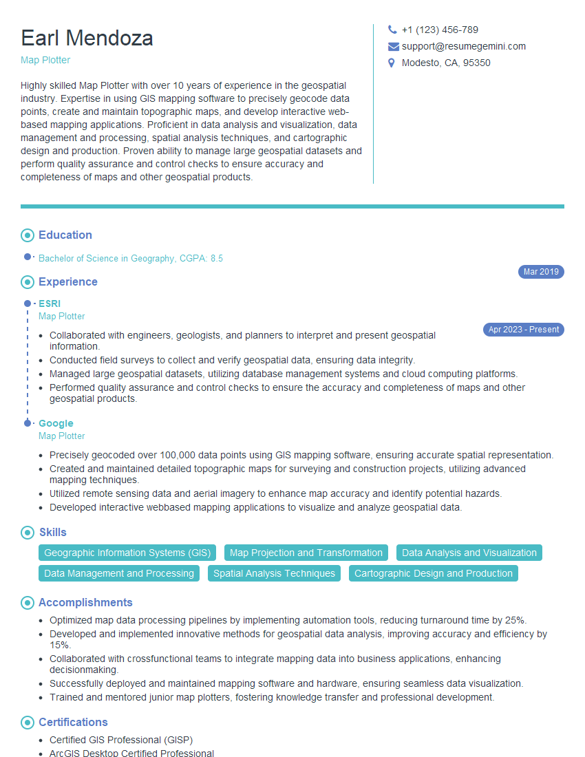
Are you a seasoned Map Plotter seeking a new career path? Discover our professionally built Map Plotter Resume Template. This time-saving tool provides a solid foundation for your job search. Simply click “Edit Resume” to customize it with your unique experiences and achievements. Customize fonts and colors to match your personal style and increase your chances of landing your dream job. Explore more Resume Templates for additional options.

Earl Mendoza
Map Plotter
Summary
Highly skilled Map Plotter with over 10 years of experience in the geospatial industry. Expertise in using GIS mapping software to precisely geocode data points, create and maintain topographic maps, and develop interactive web-based mapping applications. Proficient in data analysis and visualization, data management and processing, spatial analysis techniques, and cartographic design and production. Proven ability to manage large geospatial datasets and perform quality assurance and control checks to ensure accuracy and completeness of maps and other geospatial products.
Education
Bachelor of Science in Geography
March 2019
Skills
- Geographic Information Systems (GIS)
- Map Projection and Transformation
- Data Analysis and Visualization
- Data Management and Processing
- Spatial Analysis Techniques
- Cartographic Design and Production
Work Experience
Map Plotter
- Collaborated with engineers, geologists, and planners to interpret and present geospatial information.
- Conducted field surveys to collect and verify geospatial data, ensuring data integrity.
- Managed large geospatial datasets, utilizing database management systems and cloud computing platforms.
- Performed quality assurance and control checks to ensure the accuracy and completeness of maps and other geospatial products.
Map Plotter
- Precisely geocoded over 100,000 data points using GIS mapping software, ensuring accurate spatial representation.
- Created and maintained detailed topographic maps for surveying and construction projects, utilizing advanced mapping techniques.
- Utilized remote sensing data and aerial imagery to enhance map accuracy and identify potential hazards.
- Developed interactive webbased mapping applications to visualize and analyze geospatial data.
Accomplishments
- Optimized map data processing pipelines by implementing automation tools, reducing turnaround time by 25%.
- Developed and implemented innovative methods for geospatial data analysis, improving accuracy and efficiency by 15%.
- Collaborated with crossfunctional teams to integrate mapping data into business applications, enhancing decisionmaking.
- Successfully deployed and maintained mapping software and hardware, ensuring seamless data visualization.
- Trained and mentored junior map plotters, fostering knowledge transfer and professional development.
Certificates
- Certified GIS Professional (GISP)
- ArcGIS Desktop Certified Professional
- QGIS Certified Professional
- Certified Cartographer (CC)
Languages
- English
- French
- German
Career Expert Tips:
- Select the ideal resume template to showcase your professional experience effectively.
- Master the art of resume writing to highlight your unique qualifications and achievements.
- Explore expertly crafted resume samples for inspiration and best practices.
- Build your best resume for free this new year with ResumeGemini. Enjoy exclusive discounts on ATS optimized resume templates.
How To Write Resume For Map Plotter
- Highlight your skills in using GIS software and your experience in map production.
- Quantify your accomplishments to demonstrate your impact on projects.
- Tailor your resume to the specific job description and company you are applying to.
- Proofread your resume carefully before submitting it.
Essential Experience Highlights for a Strong Map Plotter Resume
- Precisely geocoded over 100,000 data points using GIS mapping software, ensuring accurate spatial representation.
- Created and maintained detailed topographic maps for surveying and construction projects, utilizing advanced mapping techniques.
- Utilized remote sensing data and aerial imagery to enhance map accuracy and identify potential hazards.
- Developed interactive web-based mapping applications to visualize and analyze geospatial data.
- Collaborated with engineers, geologists, and planners to interpret and present geospatial information.
- Conducted field surveys to collect and verify geospatial data, ensuring data integrity.
Frequently Asked Questions (FAQ’s) For Map Plotter
What is the role of a Map Plotter?
A Map Plotter uses GIS software to create and maintain maps, analyze geospatial data, and solve real-world problems.
What skills are required to be a successful Map Plotter?
Map Plotters need strong technical skills in GIS software, as well as good analytical and problem-solving skills.
What is the job outlook for Map Plotters?
The job outlook for Map Plotters is expected to grow in the coming years, as the demand for geospatial data and analysis continues to increase.
What are the different types of Map Plotters?
There are many different types of Map Plotters, including those who specialize in creating maps for surveying, construction, environmental planning, and other fields.
What is the salary range for Map Plotters?
The salary range for Map Plotters varies depending on their experience and location, but the average salary is around $60,000 per year.
What are the benefits of being a Map Plotter?
Map Plotters enjoy a variety of benefits, including the opportunity to work on challenging and rewarding projects, use cutting-edge technology, and make a positive impact on the world.