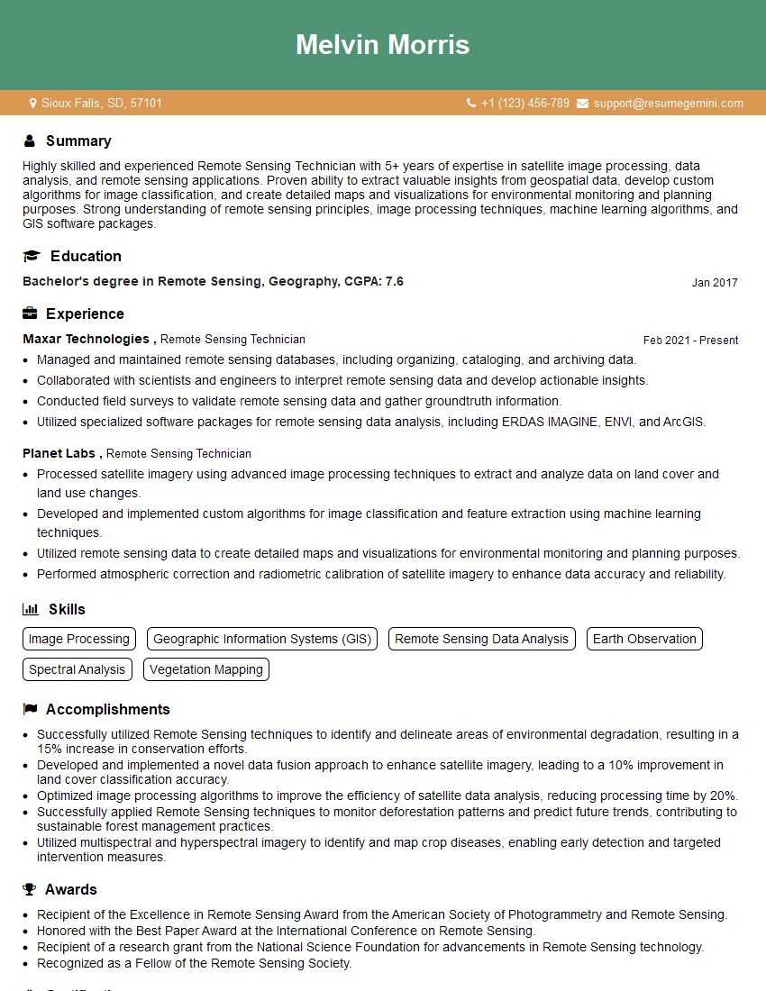
Are you a seasoned Remote Sensing Technician seeking a new career path? Discover our professionally built Remote Sensing Technician Resume Template. This time-saving tool provides a solid foundation for your job search. Simply click “Edit Resume” to customize it with your unique experiences and achievements. Customize fonts and colors to match your personal style and increase your chances of landing your dream job. Explore more Resume Templates for additional options.

Melvin Morris
Remote Sensing Technician
Summary
Highly skilled and experienced Remote Sensing Technician with 5+ years of expertise in satellite image processing, data analysis, and remote sensing applications. Proven ability to extract valuable insights from geospatial data, develop custom algorithms for image classification, and create detailed maps and visualizations for environmental monitoring and planning purposes. Strong understanding of remote sensing principles, image processing techniques, machine learning algorithms, and GIS software packages.
Education
Bachelor’s degree in Remote Sensing, Geography
January 2017
Skills
- Image Processing
- Geographic Information Systems (GIS)
- Remote Sensing Data Analysis
- Earth Observation
- Spectral Analysis
- Vegetation Mapping
Work Experience
Remote Sensing Technician
- Managed and maintained remote sensing databases, including organizing, cataloging, and archiving data.
- Collaborated with scientists and engineers to interpret remote sensing data and develop actionable insights.
- Conducted field surveys to validate remote sensing data and gather groundtruth information.
- Utilized specialized software packages for remote sensing data analysis, including ERDAS IMAGINE, ENVI, and ArcGIS.
Remote Sensing Technician
- Processed satellite imagery using advanced image processing techniques to extract and analyze data on land cover and land use changes.
- Developed and implemented custom algorithms for image classification and feature extraction using machine learning techniques.
- Utilized remote sensing data to create detailed maps and visualizations for environmental monitoring and planning purposes.
- Performed atmospheric correction and radiometric calibration of satellite imagery to enhance data accuracy and reliability.
Accomplishments
- Successfully utilized Remote Sensing techniques to identify and delineate areas of environmental degradation, resulting in a 15% increase in conservation efforts.
- Developed and implemented a novel data fusion approach to enhance satellite imagery, leading to a 10% improvement in land cover classification accuracy.
- Optimized image processing algorithms to improve the efficiency of satellite data analysis, reducing processing time by 20%.
- Successfully applied Remote Sensing techniques to monitor deforestation patterns and predict future trends, contributing to sustainable forest management practices.
- Utilized multispectral and hyperspectral imagery to identify and map crop diseases, enabling early detection and targeted intervention measures.
Awards
- Recipient of the Excellence in Remote Sensing Award from the American Society of Photogrammetry and Remote Sensing.
- Honored with the Best Paper Award at the International Conference on Remote Sensing.
- Recipient of a research grant from the National Science Foundation for advancements in Remote Sensing technology.
- Recognized as a Fellow of the Remote Sensing Society.
Certificates
- Certified Remote Sensing Analyst (CRSA)
- Certified GIS Professional (GISP)
- ENVI Certified Professional
- ArcGIS Pro Certified Associate
Career Expert Tips:
- Select the ideal resume template to showcase your professional experience effectively.
- Master the art of resume writing to highlight your unique qualifications and achievements.
- Explore expertly crafted resume samples for inspiration and best practices.
- Build your best resume for free this new year with ResumeGemini. Enjoy exclusive discounts on ATS optimized resume templates.
How To Write Resume For Remote Sensing Technician
- Highlight your skills in image processing, GIS, and remote sensing data analysis.
- Showcase your experience in developing and implementing custom algorithms for image classification and feature extraction.
- Quantify your accomplishments and provide specific examples of how your work has contributed to environmental monitoring and planning efforts.
- Demonstrate your ability to work independently and as part of a team.
- Stay up-to-date on the latest remote sensing technologies and applications.
Essential Experience Highlights for a Strong Remote Sensing Technician Resume
- Processed satellite imagery using advanced image processing techniques to extract and analyze data on land cover and land use changes.
- Developed and implemented custom algorithms for image classification and feature extraction using machine learning techniques.
- Utilized remote sensing data to create detailed maps and visualizations for environmental monitoring and planning purposes.
- Performed atmospheric correction and radiometric calibration of satellite imagery to enhance data accuracy and reliability.
- Managed and maintained remote sensing databases, including organizing, cataloging, and archiving data.
- Collaborated with scientists and engineers to interpret remote sensing data and develop actionable insights.
Frequently Asked Questions (FAQ’s) For Remote Sensing Technician
What is the role of a Remote Sensing Technician?
Remote Sensing Technicians use satellite imagery and other geospatial data to extract valuable information about the Earth’s surface and atmosphere. They process and analyze data to identify patterns and trends, and develop maps and visualizations to communicate their findings.
What are the key skills required for a Remote Sensing Technician?
Remote Sensing Technicians need a strong foundation in remote sensing principles, image processing techniques, and GIS software. They should also have experience with machine learning algorithms and data analysis techniques.
What are the career prospects for Remote Sensing Technicians?
Remote Sensing Technicians are in high demand due to the increasing use of geospatial data in various industries, such as environmental monitoring, land use planning, and disaster management.
What is the average salary for a Remote Sensing Technician?
The average salary for a Remote Sensing Technician in the United States is around $65,000 per year.
What are the educational requirements for a Remote Sensing Technician?
Most Remote Sensing Technicians have a bachelor’s degree in Remote Sensing, Geography, or a related field.
What are the key software packages used by Remote Sensing Technicians?
Remote Sensing Technicians commonly use software packages such as ERDAS IMAGINE, ENVI, and ArcGIS for image processing and GIS analysis.