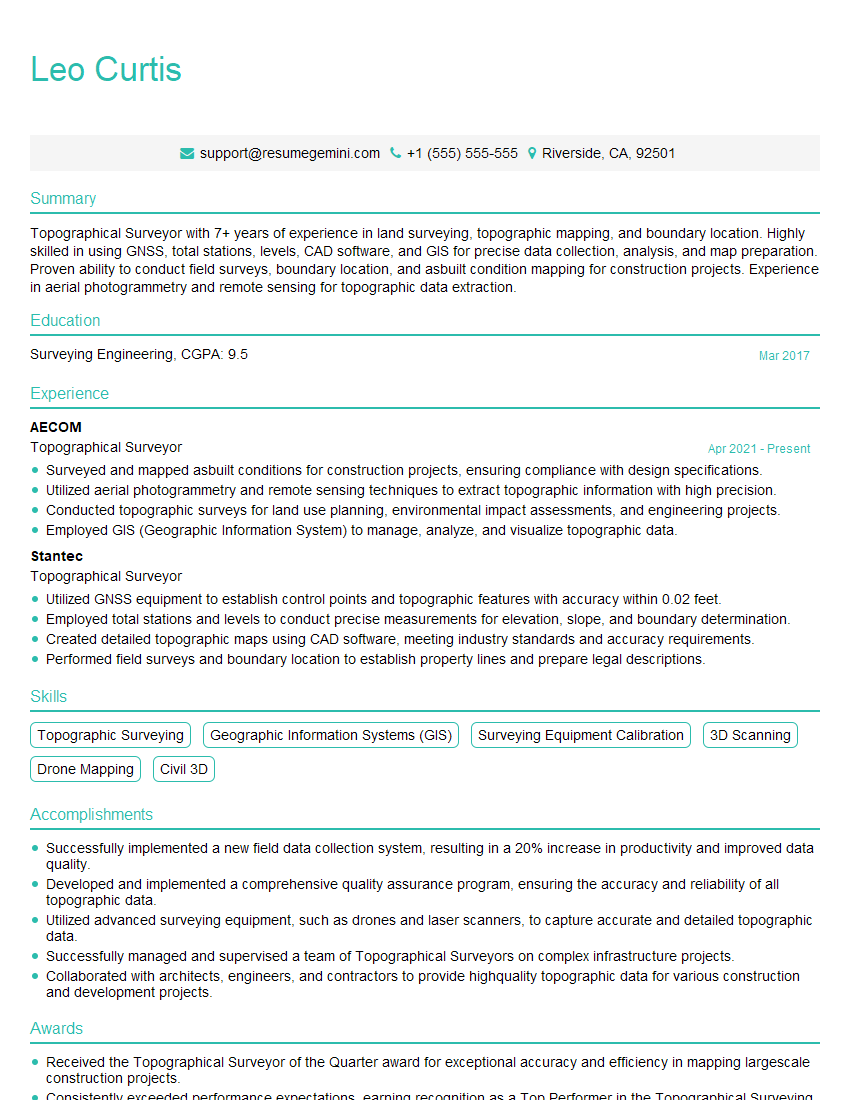
Are you a seasoned Topographical Surveyor seeking a new career path? Discover our professionally built Topographical Surveyor Resume Template. This time-saving tool provides a solid foundation for your job search. Simply click “Edit Resume” to customize it with your unique experiences and achievements. Customize fonts and colors to match your personal style and increase your chances of landing your dream job. Explore more Resume Templates for additional options.

Leo Curtis
Topographical Surveyor
Summary
Topographical Surveyor with 7+ years of experience in land surveying, topographic mapping, and boundary location. Highly skilled in using GNSS, total stations, levels, CAD software, and GIS for precise data collection, analysis, and map preparation. Proven ability to conduct field surveys, boundary location, and asbuilt condition mapping for construction projects. Experience in aerial photogrammetry and remote sensing for topographic data extraction.
Education
Surveying Engineering
March 2017
Skills
- Topographic Surveying
- Geographic Information Systems (GIS)
- Surveying Equipment Calibration
- 3D Scanning
- Drone Mapping
- Civil 3D
Work Experience
Topographical Surveyor
- Surveyed and mapped asbuilt conditions for construction projects, ensuring compliance with design specifications.
- Utilized aerial photogrammetry and remote sensing techniques to extract topographic information with high precision.
- Conducted topographic surveys for land use planning, environmental impact assessments, and engineering projects.
- Employed GIS (Geographic Information System) to manage, analyze, and visualize topographic data.
Topographical Surveyor
- Utilized GNSS equipment to establish control points and topographic features with accuracy within 0.02 feet.
- Employed total stations and levels to conduct precise measurements for elevation, slope, and boundary determination.
- Created detailed topographic maps using CAD software, meeting industry standards and accuracy requirements.
- Performed field surveys and boundary location to establish property lines and prepare legal descriptions.
Accomplishments
- Successfully implemented a new field data collection system, resulting in a 20% increase in productivity and improved data quality.
- Developed and implemented a comprehensive quality assurance program, ensuring the accuracy and reliability of all topographic data.
- Utilized advanced surveying equipment, such as drones and laser scanners, to capture accurate and detailed topographic data.
- Successfully managed and supervised a team of Topographical Surveyors on complex infrastructure projects.
- Collaborated with architects, engineers, and contractors to provide highquality topographic data for various construction and development projects.
Awards
- Received the Topographical Surveyor of the Quarter award for exceptional accuracy and efficiency in mapping largescale construction projects.
- Consistently exceeded performance expectations, earning recognition as a Top Performer in the Topographical Surveying Team.
- Received the Excellence in Topographical Surveying award for contributions to the advancement of surveying techniques.
- Honored by a renowned engineering society for outstanding achievements in the field of Topographical Surveying.
Certificates
- Certified Topographical Surveyor (CTS)
- Professional Land Surveyor (PLS)
- Certified Mapping Scientist (CMS)
- Geographic Information Systems Professional (GISP)
Career Expert Tips:
- Select the ideal resume template to showcase your professional experience effectively.
- Master the art of resume writing to highlight your unique qualifications and achievements.
- Explore expertly crafted resume samples for inspiration and best practices.
- Build your best resume for free this new year with ResumeGemini. Enjoy exclusive discounts on ATS optimized resume templates.
How To Write Resume For Topographical Surveyor
- Highlight your technical skills and experience in using surveying equipment, CAD software, and GIS.
- Showcase your ability to work independently and as part of a team in the field and office.
- Provide specific examples of projects where you have successfully used topographic surveying techniques.
- Emphasize your knowledge of industry standards and regulations, such as ALTA/ACSM.
- Consider including a portfolio of your work to demonstrate your skills in map preparation.
Essential Experience Highlights for a Strong Topographical Surveyor Resume
- Establish control points and topographic features with accuracy within 0.02 feet using GNSS equipment.
- Conduct precise measurements for elevation, slope, and boundary determination using total stations and levels.
- Create detailed topographic maps using CAD software, meeting industry standards and accuracy requirements.
- Perform field surveys and boundary location to establish property lines and prepare legal descriptions.
- Survey and map asbuilt conditions for construction projects, ensuring compliance with design specifications.
- Utilize aerial photogrammetry and remote sensing techniques to extract topographic information with high precision.
- Conduct topographic surveys for land use planning, environmental impact assessments, and engineering projects.
Frequently Asked Questions (FAQ’s) For Topographical Surveyor
What is the role of a Topographical Surveyor?
A Topographical Surveyor is responsible for gathering accurate data about the physical features of the earth’s surface, including elevation, slope, and boundaries. This data is used to create topographic maps, which are essential for land use planning, construction projects, and environmental studies.
What are the key skills required for a Topographical Surveyor?
Key skills for a Topographical Surveyor include proficiency in using surveying equipment, such as GNSS, total stations, and levels, as well as CAD software and GIS. Strong analytical and problem-solving skills, attention to detail, and the ability to work both independently and as part of a team are also essential.
What are the career prospects for Topographical Surveyors?
Topographical Surveyors are in high demand due to the increasing need for accurate topographic data for land use planning, construction projects, and environmental studies. With experience and additional certifications, Topographical Surveyors can advance to roles such as Project Manager or Chief Surveyor.
What are the typical working conditions for Topographical Surveyors?
Topographical Surveyors typically work outdoors in various weather conditions, including heat, cold, and rain. They may also work in remote areas or on construction sites, which can involve physical exertion and potential hazards.
What is the salary range for Topographical Surveyors?
The salary range for Topographical Surveyors varies depending on experience, location, and the specific industry. According to the U.S. Bureau of Labor Statistics, the median annual salary for Surveyors is around $67,000.